
|
London's Rivers |
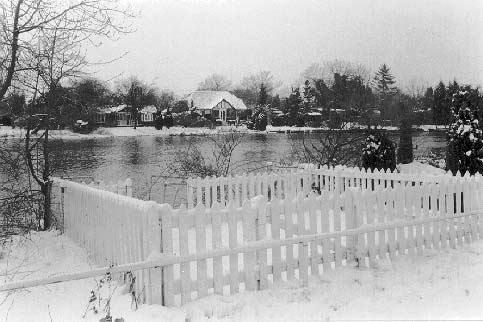 |
River Thames Riverside Garden, Old Windsor Old Windsor, a mile or so downstream from the castle, was the original town. It is now a quiet suburb by the river, looking across to Wraysbury. Magna Carta was probably signed about a mile downstream from here. Quite how gardens have been allowed to be fenced in between the towpath and the river is difficult to understand. |
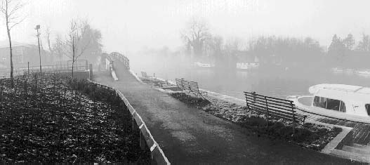 |
| River Thames Staines Staines, was not long ago a small market town on the edge of London. People used to travel by train or omnibus for a day out on the river. Most of the old boat yards are now offices or housing. The bridge on the towpath leads to one currently threatened by this - it was built to replace one already covered by offices. Church Island - through the mist - is one of many inhabited islands in the non-tidal Thames. Just behind Church Island was the London Stone, marking the upper Limit of the jurisdiction of the City over the river, The original is now in the Coffee bar of the local arts centre. |
downriver »
©Peter Marshall 1997
These pictures are part of a large collection taken since 1980 by Peter Marshall.![]() Information on these pages comes from a
number of sources, but one of the best general books on London is:
Information on these pages comes from a
number of sources, but one of the best general books on London is:
The London Encyclopaedia,
Edited by Ben Weinreb and Christopher Hibbert, Macmillan, London 1983 : ISBN
0 333 30024 6.
Those wishing to explore the Thames on foot will find The Thames Path, National Trail
Guide, by David Sharp, Aurum Press 1996 : ISBN 1 85410 406 3 extremely useful.
Please email him if you would like to make use
of them in any way or buy copies.![]()